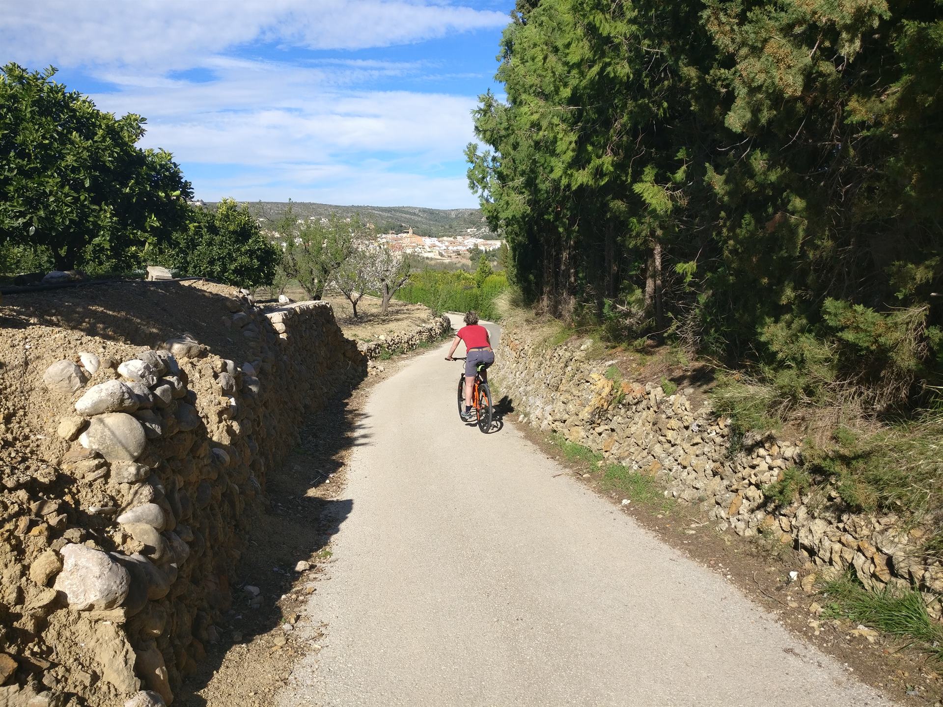
Bike
From a relaxed loop through the valley to the Coll de Rates and the Cumbre del Sol: the cycling here is wonderful.
Cycling in the Marina Alta
In the low mountains of the Marina Alta (roughly the area between Calpe, Denia and Alcoy) the cycling is wonderful. Villa Arbolada itself has three mountain bikes and a road bike available. These bikes are suitable for the undemanding cyclist who likes to stay on the asphalt. They can be used, for example, for a trip to a restaurant or modest (family) outings. For the junior enthusiast we have recently added a 24-inch bike with gears, but beware: the last slope up to the villa is very steep!

Hiring bikes
For serious cycling you can hire carbon road bikes, mountain bikes, or electric city/mtb/road bikes in Jalón at AltaBikeRental or VeloSol, or at Xabias Bike in Denia. They can deliver to Alcalalí on request, but it is advisable to reserve in advance.
You can also hire mountain bikes at Snakebite Adventures in Moraira. They also organise day trips (including bike hire), at all levels from beginner to advanced. Full-suspension mountain bikes are available if required at Kunz in Denia; here too, reserve in good time.


MTB routes around the Jalón valley
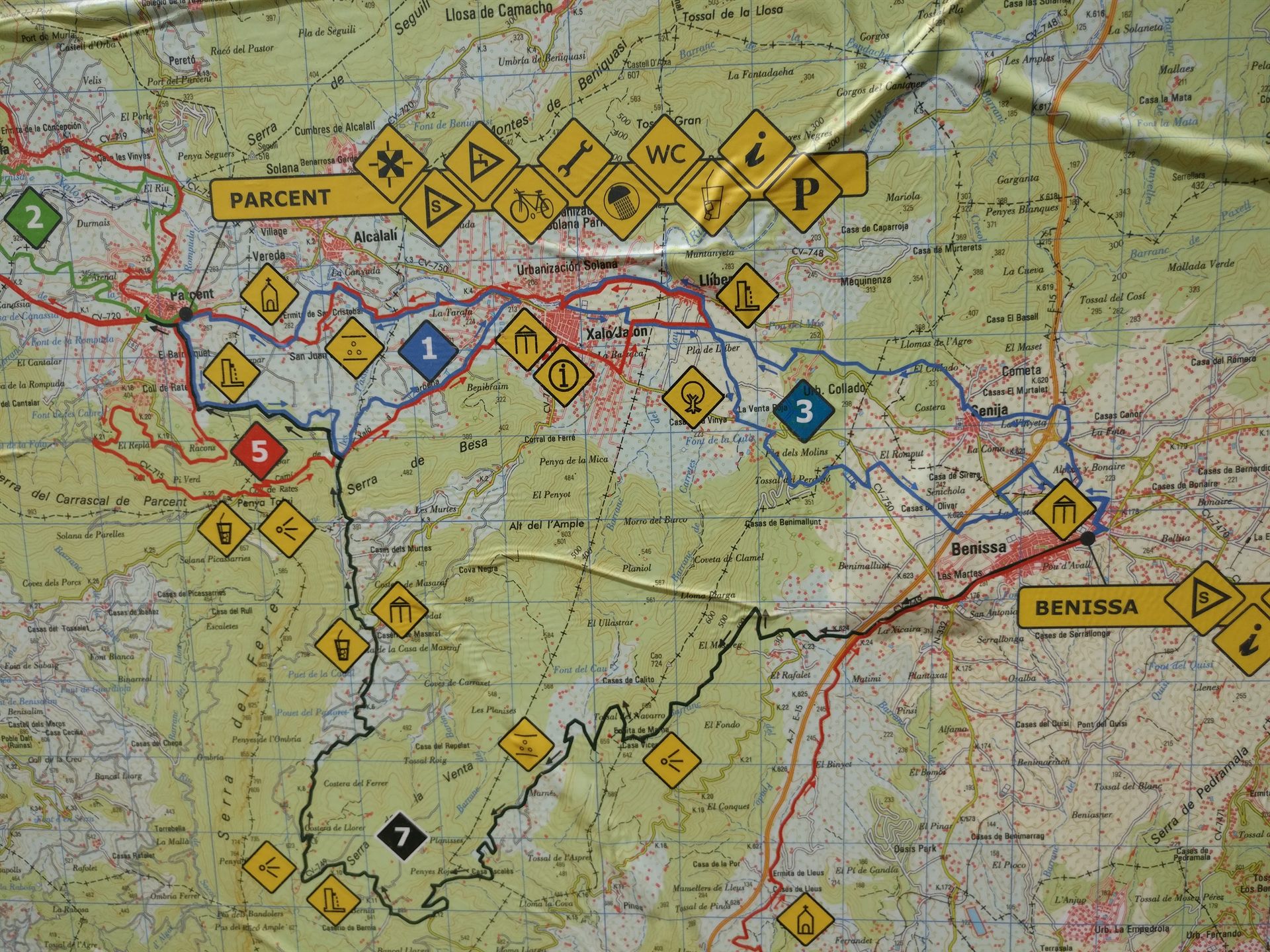
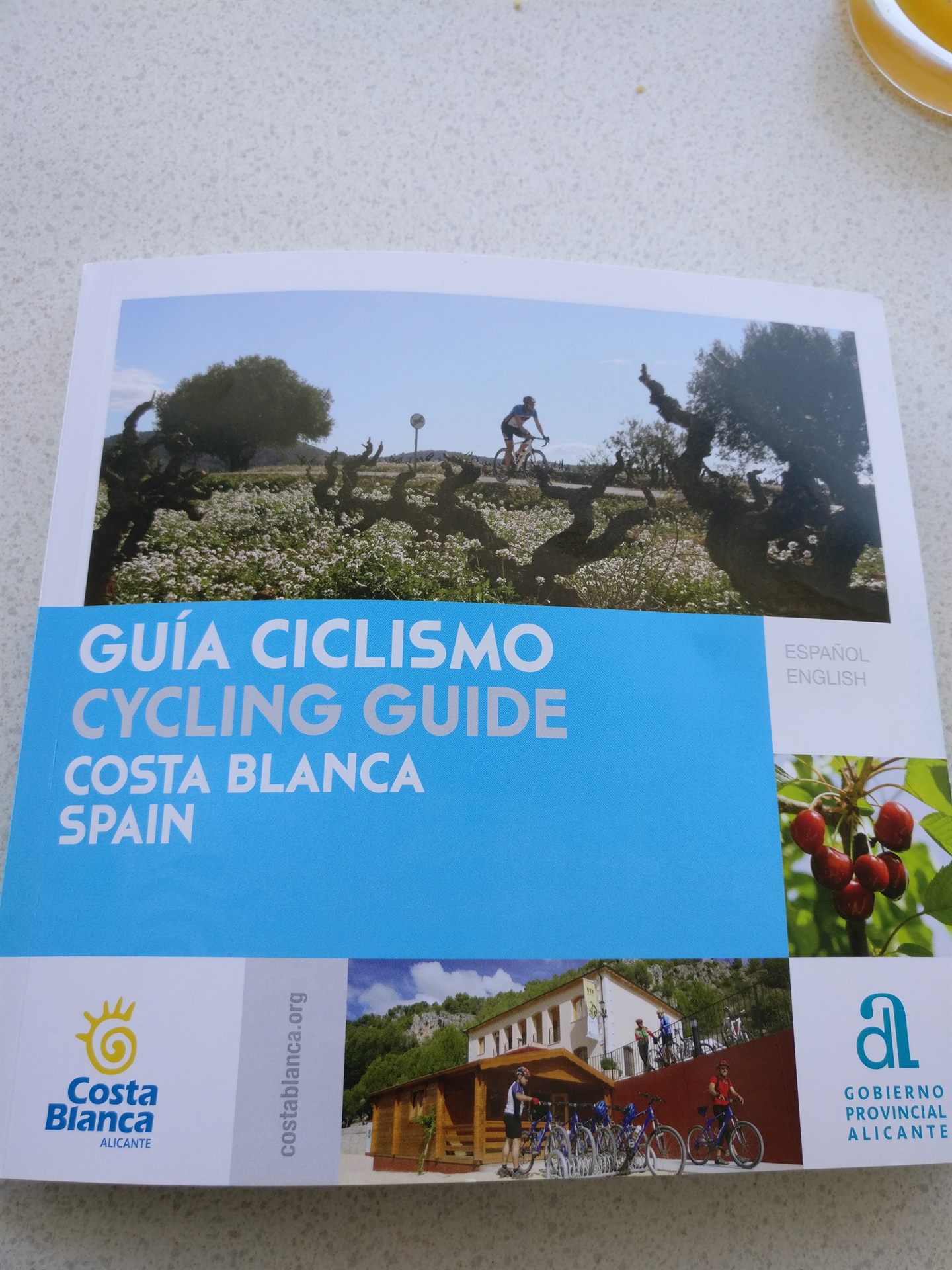
The mountain bike centre in Parcent has already marked out several mtb routes (from very easy to very hard) in and around the Jalón valley. You will also find those routes in the leaflet in our information folder in the villa.

Planning your own routes with Komoot
For planning routes yourself I recommend Komoot. A free app and website, flexible to use, and once you have the app you can also download my routes below.
Below is my favourite loop (suitable for both mtb and road bike). But without that Cumbre d’Alcalalí — that is only fun for the real die-hards… The loop can of course also be ridden the other way round; the climb (from Castell) is then a bit harder. NB: from the Coll de Rates you can see Villa Arbolada!

More fine routes, with a link to Komoot
All on roads that are now fully surfaced, and predominantly very quiet but good roads. The further you stay from the coast, the quieter it is.
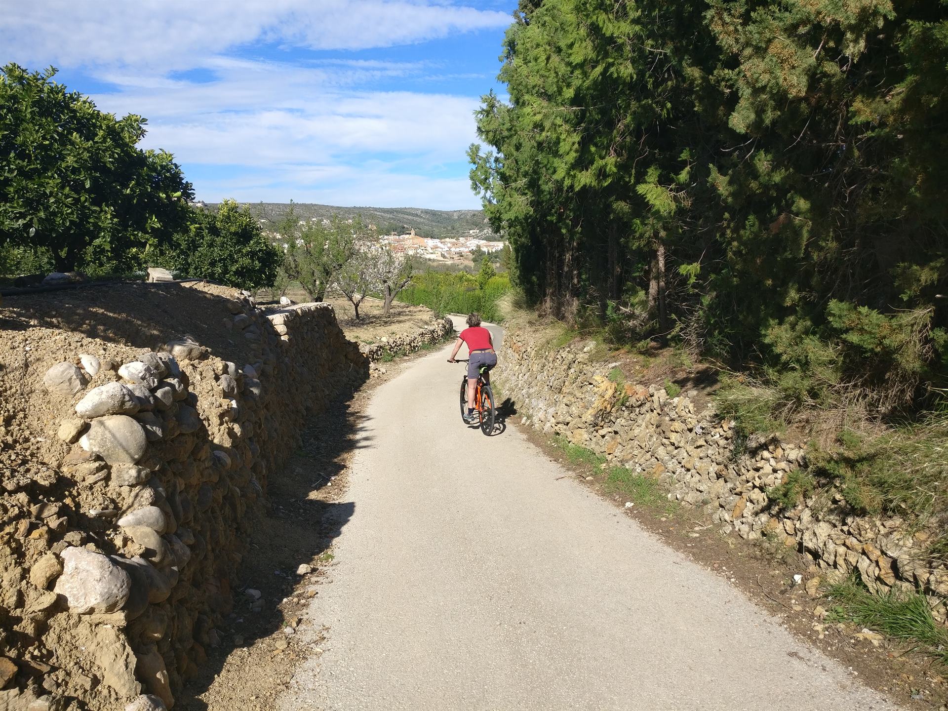
For in between — up to 45 km
Murla-Laguar (20 km, 360 hm)

Just testing the calves. A lovely ‘in between’ loop to get the cardio going without being out for hours straight away. My favourite training loop when I do not fancy the crowds on the Coll de Rates. First, after Murla, a view of the wall of the Fontanilles sanatorium. Then nicely up and down through the quiet woods, saying hello to the little donkeys along the way, and once up in Fleix a delightful descent to Orba. Finally the short little climb of the El Portet pass and you are home again. You can of course also ride this route the other way round, but I think the climb from Orba to Fleix is finer as a descent.
A variant is simply to turn round at the top in Fleix and take the same road back. Then you get the up-and-down-through-the-pine-woods again, and that route is great fun as a descent too.
Lliber – Monte Pego (30 km, 450 hm)

An easy route for (almost) the whole family. That is to say: apart from the climb at Monte Pego, which is quite tough (and the descent is steep). The second part, from Pedreguer back to Alcalalí, can be a bit busier depending on the time of day. But in general the drivers here are very used to cyclists and friendly in character too.
Serra de Bernia (42 km, 700 hm)

You really have to have done this one! A fairly steady climb of about 5% through fantastically varied country. And once at the top, a good paella at Refugio Vista Bernia, of course! The descent on the east side is very steep at the start, but after that it runs beautifully downhill with fine views. Once you are back down you can of course ‘just’ take the CV-750 back to Jalón, but surely you did not get on a bike to ride along that busy main road? I prefer to ride through the campo, to Senija and then left towards Jalón on the much quieter main road. Halfway down the descent I take the surfaced track to the left (take care not to ride past it) and continue downhill. Suddenly you are standing in the middle of the essence of the Jalón valley: the vines of the mistela grapes! And do not be surprised if you meet a donkey cart here; they really are still used regularly.
Coll de Rates – Crueta loop (45 km, 940 hm)

A fine introduction to the area, a relaxed climb. You really ought to have done this one at least once too… The Coll de Rates is probably known to every enthusiast: it is the mountain on which Jonas Vingegaard was discovered, on which Tadej Pogacar tries to set a new KOM every winter, and over which all the cycling tourists from Calpe and Denia come daily. Even so it is still not too busy, and in any case a very pleasant climb with fine views over the whole valley and far beyond. In clear weather you can even see Ibiza. It is never really steep either; every time, I understand again why this climb is so popular. After the Rates a fine linking section, down and up again towards Tarbena. Before the village you can eat outstanding paella to the left at Cas Pelut, but we turn right and keep climbing to Sa Crueta. The last kilometres of this climb have a few nice surprises in store… And do not forget to look back now and then; you get a fine view towards the coast. The descent to Castell de Castells is fast and wide, apart from two hairpins! After the village you want to make sure you are not on your own, because then it really is a false flat in the big ring down to Benigembla. In winter many a professional team comes here to the CV-720 to train its team time trial. 😉
You can also ride the loop above the other way round perfectly well. You then start with about 25 km of false flat, followed by the much steeper side of the climb.
Tip: because you are staying at Villa Arbolada, you do not necessarily have to go up in the hottest part of the day just because you then have to ride all the way back along the busy road to your hotel in Calpe. You can also (like many other ‘locals’) simply blast up the Coll de Rates at the end of the day, turn round there and be home again within the hour.
A solid day — 50 to 80 km
Vall d’Ebo (50 km, 1000 hm)

Climbing from Pego, then through the valley. From Pego a more or less ‘traditional’ climb, with nice hairpins. Then only a short descent, because you come out in a valley. At the village of Vall d’Ebo left and briefly steeply uphill, then a fine quiet lane that was only surfaced a few years ago. After Pla de Petracos (ancient rock paintings) you join the big-ring-home route that you will probably recognise from the Rates–Sa Crueta loop above.
Quatretondeta (73 km, 1200 hm)
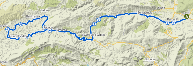
Quiet, beautiful interior but steep now and then. On this route you start calmly (but steadily) with the false flat to Castell de Castells mentioned earlier, but then uphill. After the village you climb into the woods, past the tiny villages of Famorca and Fageca, after which the up-and-down section towards Quatretondeta begins. That is quite spectacular, the better sort of interval work between weathered karst formations. The punchers can let themselves go here, and so can the nature lovers. A unique little road, though narrow at times, so stay alert! To keep the distance manageable the loop turns back after Quatretondeta. Should the legs be able to take more, at km 43 (Tollos) you can always opt for the longer variant (see below).
Vall d’Ebo y Vall de Gallinera shortened (clockwise, 65 km, 1200 hm)
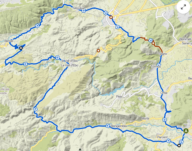
Three valleys, shorter version
This route takes you from the Jalón valley through three more valleys: first the Vall d’Ebo, then part of the Vall de Gallinera and finally the Vall d’Orba. You start with the false flat uphill towards Castell de Castells (CV-720), but after the bridge (at Pla de Petracos) you turn right onto a small road that was surfaced not so very long ago. After the descent to the village of Vall d’Ebo (the last stretch is quite steep) you climb again on a larger but still quiet road (CV-712), and halfway across the plateau you take a side road to the Mirador del Xap. That gives you a fine view over the Vall de Gallinera, and the (fairly steep!) descent with hairpins. Down in Benialí you follow the road through the valley (CV-700); here the chance of meeting motorised traffic is a bit greater (Pego is a somewhat larger town). Mathieu van der Poel usually goes up from Pego to the Puerto de El Miserat, but I cannot recommend that 23% climb to you. Better to carry straight on in Pego along the CV-715, a very relaxed climb to Sagra with a relaxed descent. The Vuelta came past here in 2026, so the asphalt is perfect. Via Orba one last hairpin back home, and then, for the Strava fans, a final sprint on La Solana Madness 🙂
Vall d’Ebo y Vall de Gallinera (clockwise, 79 km, 1400 hm)
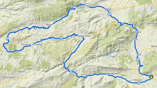
The best of the 3 valleys
The longer variant of the three-valley route above. After about 30 km this one does not go to the Mirador de Xap, but continues across the plateau. Via the fine, fairly quiet CV-712 to Alcala de la Jovada and on to the junction with the CV-700. Here you descend steadily through the Vall de Gallinera, with a side road in between that rejoins the CV-700 at Alpatró; if you would rather stay on the smooth asphalt, that is of course also possible.
Vall de Gallinera y Vall d’Ebo (anti-clockwise, 79 km, 1400 hm)
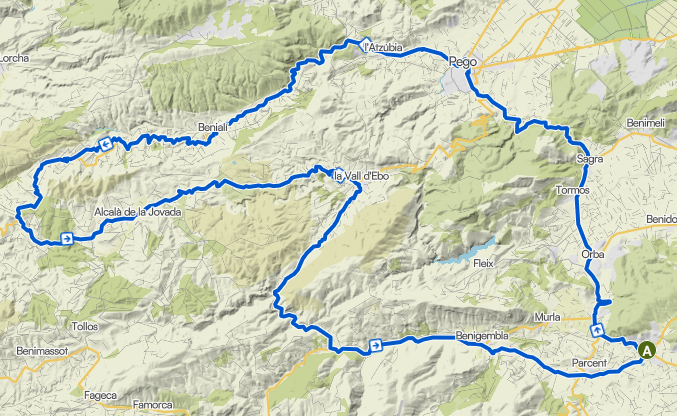
You can of course also ride the loop above the other way round. The difference is that you then first ride the false flat uphill in the Vall de Gallinera, with the climb up to the plateau after 36 km. You also get two short steep little climbs then: one after about 22 km at the start of the valley, and a slightly longer steep climb after the village of Vall d’Ebo. As a bonus you then get the lovely big-ring-home route along the CV-720 that you probably already know from the Rates–Sa Crueta loop above.
All-out — 85 km and more
Quatretondeta (85 km, 1500 hm)

Quiet, beautiful interior but nowhere flat. The slightly longer variant of the one mentioned earlier. This variant turns left at km 43 towards the Puerto de Tollos. Then a long descent on fine asphalt, only to climb again (briefly steeply) just before Vall d’Ebo and then head home in the big ring along the CV-720.
Guadalest – Gorga circuit (98 km, 2100 hm)
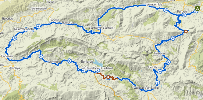
For those who really want to go all out… If you do not shrink from a substantial outing on the road bike, this route combines a number of fine elements from the previous ones. First the climb of the Coll de Rates and Tarbena, after which you come into the busier part of the region because you descend the mountain on the Benidorm side. The stretch up to Guadalest can be busy with traffic, because it is a very touristy destination. But after that you are suddenly in the quiet interior of Confrides, and you ride the spectacular up-and-down course past Quatretondeta. After the descent to Castell de Castells the dessert begins: home in the big ring! Along the false flat of the CV-720, through and off, a bit of team time trial practice 🙂
On the mountain bike
Calpe through the campo (45 km MTB, 630 hm)

Off the beaten track, though the climbing is largely surfaced. It is always a mystery to me why so many cyclists choose the mega-busy 80 km/h N332 for the stretch between Calpe and Benissa. Even on asphalt that road can be avoided, but this is a variant with a few unsurfaced sections in it. Perfectly doable on a road bike, but a mountain bike is of course more comfortable. It is always funny to see how much beautiful nature there actually still is to be found, so close to a fairly heavily built-up coast. On the way back do not forget to make a stop in Benissa at the ice cream parlour, because that really is worth the detour!
The climbs in the area
The best-known climbs nearby, with the side from which you can ride up them:
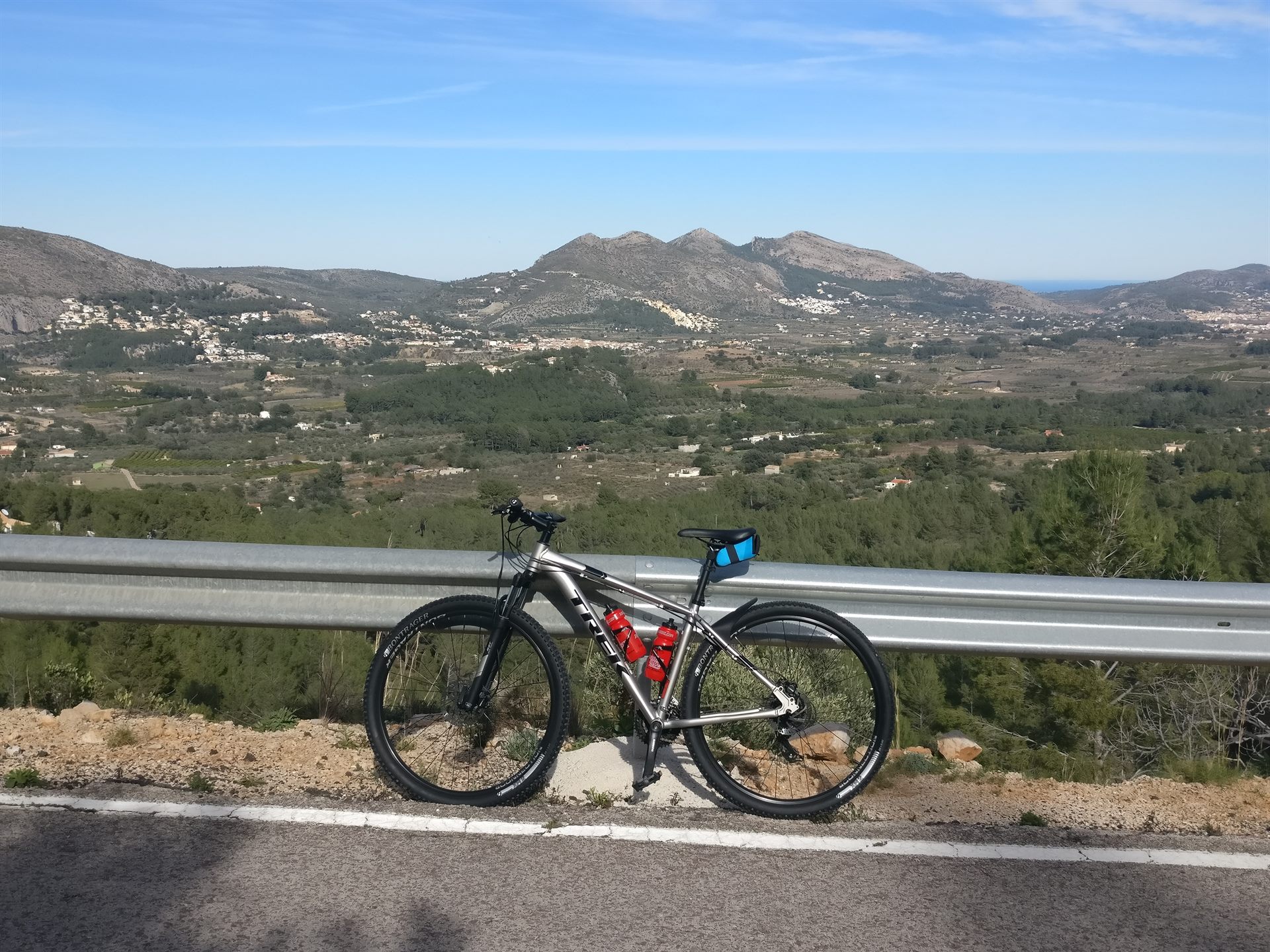
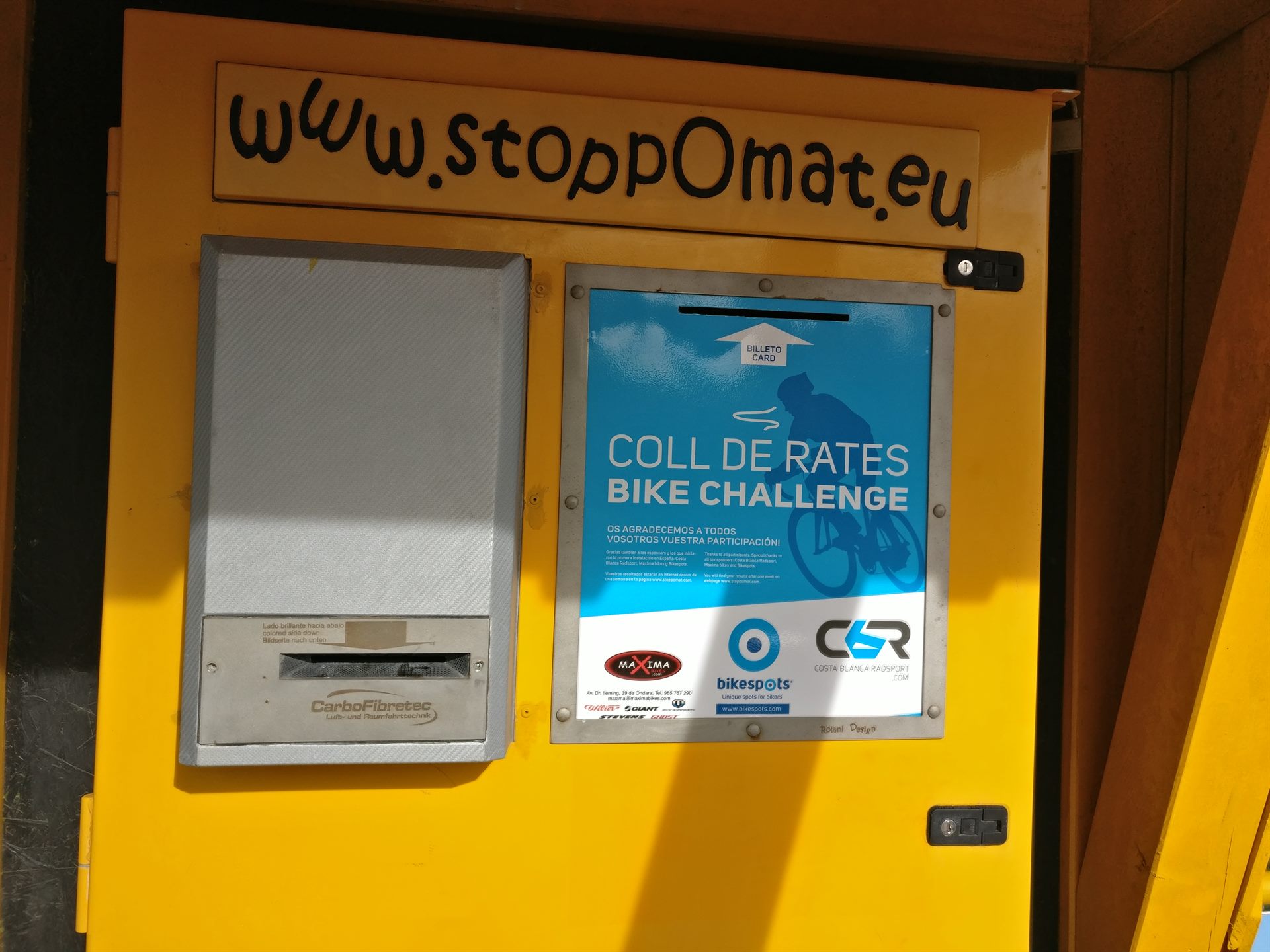
- Coll de Rates — from the north side and from the south side
- Bernia — from the east side and from the west side
- Corrals d’Alt — east side via the CV-715/CV-752 from Callosa, west side via the CV-752
- Llosa — east side, from Pedreguer to Alcalalí
- Margarida — east side, CV-700 from Pego
- Planes — north side from Denia, south side from Javea
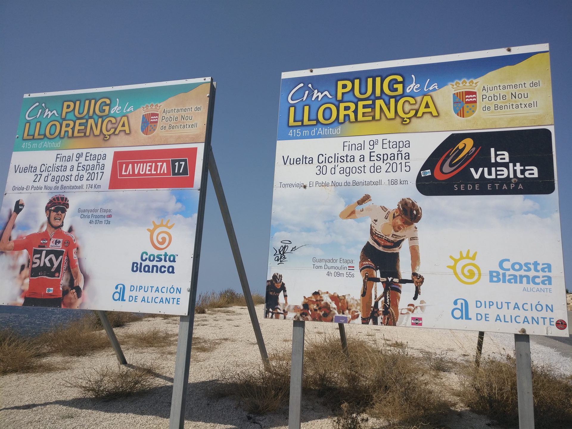
- Puig Llorença (Cumbre del Sol) — where Dumoulin beat Froome for the first time
- Tollos — north side via the CV-713 from the CV-712, south-east side via the CV-720 from Castells, south-west side via the CV-720 from Gorga
- Vall de Ebo — east side via the CV-712 from Pego, west side via the CV-712
Curious about the gradient profiles? For virtually all of these climbs the profile — with the percentages per kilometre — is on cyclingcols.com. Handy for deciding in advance what you fancy.


More routes still
More cycle routes in the area, including an MTB variant, can be viewed on my page on Routeyou.
Do you have nice cycle routes or good tips of your own? Let us know please!
Beach, bike & hike
Cycling is just one of the ways to discover the Jalón valley.